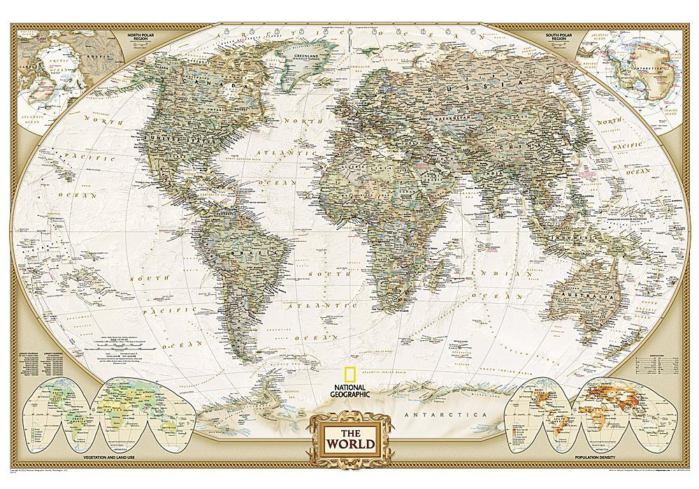
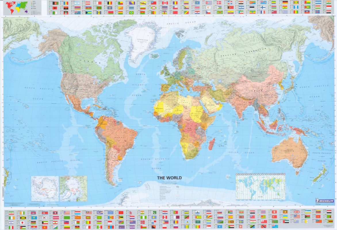
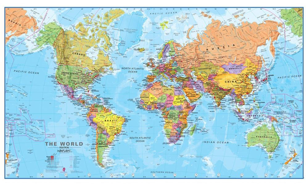
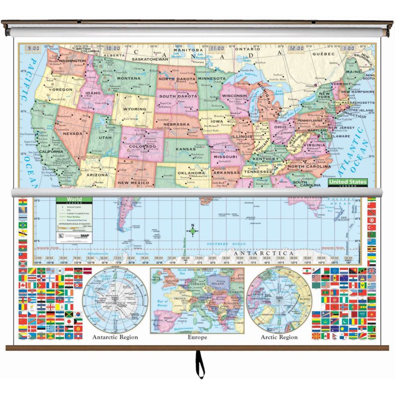
Maps of the World See more maps from The Map Shop The world maps we endeavor to provide are the most up-to-date Political, Physical and Stylized maps available in sizes from small to wall murals.  Our shopping cart system will let you add the option of  walnut-grained rails on the top and bottom or spring rollers. Unless otherwise noted, all these maps come standard with lamination on both sides for a surface you can write on & wipe off. You may call us direct @ 800-532-6675 (9a~6p Eastern time) should you require assistance or prefer personal service. Otherwise, just click on one of these map images for a larger picture, pricing, availability and Order Entry or send us an inquiry  Click here for US maps, Continent maps, Antique World maps, Country maps, Globesfolded travel maps  or map pins instead. Want a world map on spring rollers? See our World Classroom maps
 
Wall map home pageUS maps[See what is in your shopping cart]See all the various ways we can mount and frame your mapFeedback about wall mapssearch the text in our siteBest World Maps See our mounted maps at our World Travels page

like us or link us at our Facebook page and get a special deal.

Our Most Popular World Maps

Our favorite world map because the type is so easy to read
Our popular Political Map

This is probably the best physical map of the world we have ever seen. It matchs the Terra Nova political to the left
Our best Physical Map

NGWRLD-EXEC-over.JPG (397697 bytes)
comes as a big mural too!
We have a large collection of world maps already in elegant walnut frames
   Four different sizes!
 TerraNova style Map

Physical World Map

Executive Series in 4 sizes See our  Framed Maps

Time Zone Maps

Michelin world map showing flags that form a country oriented map index

 World mural put up as wall paper in 8 sections
<----13 feet wide---->

ngworld-over.jpg (1004319 bytes)
(available in wall paper)

 Another antique look world map by Rand McNally
rich antique look

World map in three different sizes
Small World Map
Large World Map
Michelin map World Wall Paper 13.5 x 8.5 feet

 Nat'l Geo in 3 sizes

 Rand-McNally Classic World

Learn More...            We also sell a lot of the more unusual World Maps below...
This is map is a great discounted price world map by Rand-McNally

Roll-up world maps in a classroom style, but good for any environment where the maps need to be on a spring roller

Elegant World Map with muted colors and easy to read text
This also has an antique look and can be plotted at any size

indestructible world map made of Tyvek
not laminated.. It's Tyvek!!

Rand-McNally M Series

Classroom World Maps

Map with Muted Colors

Tyvek World Map

Illustrated Map
The old-fashioned look of the world elegant antique world map reproduction Children's world map with 1000's of interesting imbedded graphics showing activities by region

Simple world map click here for large picture, price and add to cart button

Pacific centered World Map
2 Hemisphere World Small Antique look,

Childrens  Map

Simple World Map

Pacific Centered World

Simple illustrated World Map by Rand McNally

 
(designed to look old)

National Geographic's multi-color wall map

World or US maps on a spring roller

inexpensive map of the world

Childrens Map by Rand

Antique look, World Map

National Geo. Decorator Series Roll-up School Maps Inexpensive World Map

OK, these World Maps are a little unusual, but they might be just what you're looking for

Upside Down Map of the world with interesting world projections at the bottom mouse pad that is also a world map with a non-skid finish the peters projection world map shows continents with correctly proportioned areas National Geographic's purely physical world map with space imaging enhancement This world map has bumps to show mountains. It's a great child pleaser and educational too  3-D with raised mountains

Upside Down World Map

World  mouse pad

Peters Projection

National Geo Physical

Raised Relief by Rand

this map shows the world from space same as the Terra Nova map at the top of the page, but with all the worlds country flags at the bottom

world map showing countries in relative size to their population

World map mural 3 by 6 feet
Wall Map Mural with an Antique Look

world at night showing illuminated cities from space

World from Space

Terra Nova with country flags

World Population Map

Antique World  Mural

World at Night

world map showing colored elevations and topography
also World Mural wall paper
       
Geophysical World Map        

 Click here for more details about what rails or Martin Mounts are all about. To view our return policy click here.

Click on one of these links to see all the different types of wall maps we have:
WorldContinentsCountriesUSIndividual StatesGreat American Cities Antique ReproductionsBible LandsClassroomCustom, Foreign LanguageFramed Maps,   Shipwreck

 Send mail to mapguy at mapshop.com (please replace the "at" and spaces with the @ symbol) with questions or comments about this web site.
If necessary, see how to ship these maps internationally.